Severe Weather LIVE BLOG - June 17, 2025
10:00 PM CDT | June 17, 2025 - Multiple Tornado Warnings and Severe Thunderstorm Warnings are ongoing right now.

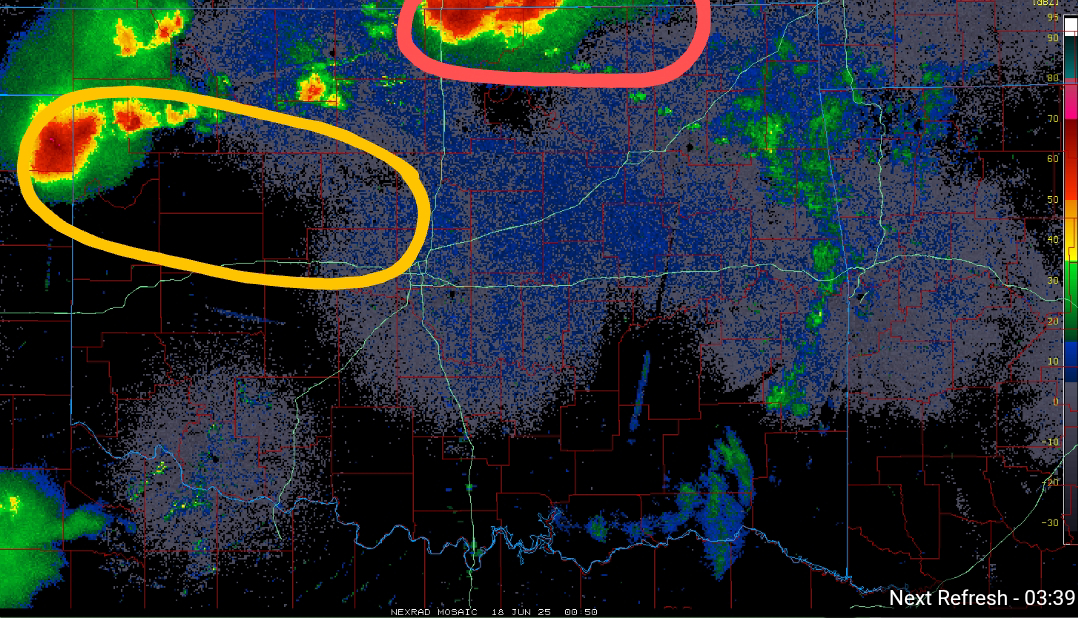
7:55 PM CDT | June 17, 2025 - Going forecast looks good this evening. Primary area for Severe Weather over the next couple of hours will be in far Northern Oklahoma, where I have outlined in Red. This is where the greatest risk for Tornadoes will reside in the near term. There is a secondary area that will see an increased risk for Severe Weather, which I have highlighted in Yellow. This area of convection will impact areas along/N of I-40 to the west of Oklahoma City over the next 2-3 hours. This activity will track into the region which was pulsed by various radar sites multiple times earlier today. Damaging Winds of 60-80 mph will be possible, as well as Large Hail and perhaps even a Tornado or two.
4:10 PM CDT | June 17, 2025 - A TORNADO WATCH is in effect until 10:00 PM for much of Northern/Western Oklahoma. Primary hazards will be Damaging Winds and Hail, both of which could be significant, with the most intense storms. A few Tornadoes are possible as well, especially with any outflow boundary interactions.

2:20 PM CDT | June 17, 2025 - In addition to Northern Oklahoma of course, there is an area in particular I am watching for Severe Weather later this evening and overnight. It is generally along the I-40 corridor, near and to the west of Oklahoma City. There have been several radar pulsing signatures noted since early this morning toward this region. View the graphics below...


Right now, we have Severe Thunderstorms in Kansas with development expected farther south into Northwest Oklahoma and the eastern Texas Panhandle between 4:00 and 6:00 PM.
I have highlighted below the region where I believe they are charging the environment through ionization and frequency for increased severe potential this evening.

--------------------
As seen on the Facebook page earlier:
"10:10 AM CDT | June 17, 2025 - There is a risk for Severe Weather this evening and overnight. The greatest risk is across Northern Oklahoma, where significant Severe Weather is a real possibility. The overnight cluster in Kansas dropped farther south into Oklahoma than the models predicted, which does not bode well for this evening because it is a sign that the cap may be more penetrable.
A few hi-res models have gone more aggressive with storms along/north of I-20 tonight. The environment will be favorable for Severe Weather with any storms that break through the cap and sustain themselves. Damaging Winds of 60-90 mph will be possible, as well as Quarter to Baseball-size Hail and a few Tornadoes. The Tornado Risk will be locally greater near any outflow boundaries"


Comments
Post a Comment