Severe Weather LIVE BLOG - Sunday, May 18, 2025
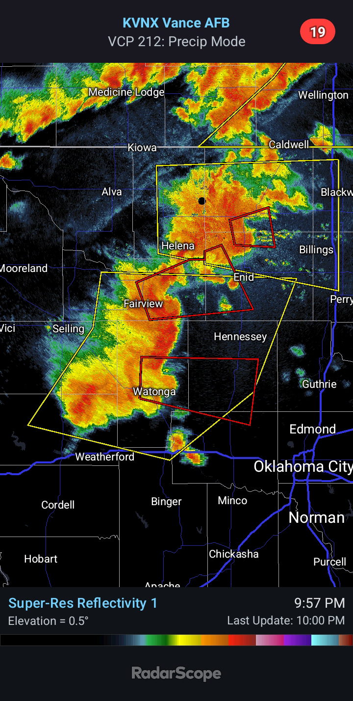
11:50 PM CDT - Today's Severe Weather event across Oklahoma did not unfold as expected. While it is never good that a forecast busts, it is a positive that this one did. At least a couple Tornadoes did touch down with a cell in Northwest Oklahoma, which originally formed in the Texas Panhandle. Interestingly enough, not a single weather model had forecast ANYTHING to develop in the Texas Panhandle. More on this shortly...
Otherwise, the state was largely quiet compared to areas north and south. Multiple Supercells impacted Kansas and Texas. A multi-vortex Tornado was observed to the west of Fort Worth early this evening.
In regards to the models, the reason none had any development in the Texas Panhandle is because none had the dryline positioned that far west this afternoon. They all mixed it too far eastward. A few of the hi-res models this evening did not analyze the dew points correctly, and thus, their output is skewed too far to the east. This is an important trend to realize, because these same models mix the dryline to OKC between 5:00 and 7:00 PM on Monday. This would place the focus for significant Severe Weather on areas immediately along the I-35 corridor and points east. Areas farther west would only have a short window for Severe Weather during the mid afternoon hours. The A.I. model guidance so heavily relied upon now by meteorologists features a few of these same models which have struggled. One particular model this morning had depicted the dryline to mix as far east as a Lawton to Enid line by 7 PM today. In reality, the dryline was located along the Texas/Oklahoma state line - a difference of over 90 miles. Its baseline analysis this evening was still off by 40 miles.
All of this is to say that I believe the dryline will stall somewhere between Hydro and El Reno late Monday before being overtaken by the Pacific cold front later Monday evening. Below is the current outlook for tomorrow. I believe this outlook still looks in good shape. My concern is that with the next outlook issued at 1:00 AM, they may shift probabilities eastward... because of several models mixing the dryline to OKC by late afternoon/early evening, despite it being based on junk handling. We will see. I will start a new LIVE BLOG in the morning and post throughout the day.
7:00 PM CDT - Despite even better model consensus that we would see scattered supercells across Western Oklahoma this afternoon and evening, there has only been one notable storm. Looking at visible satellite, the earlier cumulus field across western portions of the state has struggled and looks largely flat now. With increasing convective inhibition as a result of cooling temperatures, additional storm development is looking much less likely. I would not be surprised to see the Tornado Watch canceled early for multiple counties.
4:00 PM CDT - A TORNADO WATCH is in effect until 10 PM for Western Oklahoma.
2:00 PM CDT - The latest model guidance continues to trend more aggressive with storm development in Western Oklahoma later this afternoon. This is what one of the models is now depicting at 4:00 PM. Several runs ago, it had zero storms outside of far Northwest Oklahoma. The risk for Significant Severe Weather is real today.
Clouds are breaking up over this area and helping to contribute to high and even extreme instability values.
11:00 AM CDT - One of the models that is commonly used now, the HREF/Nadocast, shows heightened significant Tornado probabilities across Northwest/Western OK today with increased risk for loss of life. Be prepared today, should a watch or warning be issued for your area. A watch means conditions are favorable for the development of severe weather - be prepared and stay alert for rapidly changing weather conditions. A warning means severe weather is imminent or already occuring - seek shelter immediately.
8:35 AM CDT - The SPC made some tweaks with their latest outlook, upgrading parts of Northwest Oklahoma to a Moderate Risk and Southwest Oklahoma to an Enhanced Risk. Otherwise, little has changed since the previous update (see below).
Radar pulsing was observed from the Amarillo radar last night and this morning. This broad spraying-type signature is what has been associated with "charging" the atmosphere through ionization. It was seen from the Lubbock radar yesterday, directed toward Western/Southwest Oklahoma. This was hours before the cluster developed and tracked right along I-40 overnight, producing Large Hail and Damaging Winds. Do with this knowledge what you will...
I will do my best to keep you all posted on the weather into tonight. Stay tuned.


Comments
Post a Comment