Posts

Showing posts from June, 2025

First Long-Range Tropical Prediction Of The Season

10:00 PM CDT | June 23, 2025 - You heard it here first... Elevated risk for tropical activity in the Gulf of Mexico beginning the third week of July. This period will continue into the first few days of August. This is based on the cycling weather pattern which set up last fall. I will have more on this in the coming days. Stay tuned.

Recap Of The June 17, 2025 Severe Weather Event

Image
7:30 AM CDT | June 19, 2025 -  As I often do on here, I go back and see just how well a forecast verified. My analysis and forecasts are not conventional and take into account weather modification among other things. On Tuesday morning, I saw typical radar pulsing signatures targeting parts of Western Oklahoma. These appeared to be what they do ahead of storm development to locally charge the atmosphere through ionization. You can view those particular images in the previous post. By early afternoon, I had seen enough and took note that no chemtrails were being utilized in the hours ahead. The stage was being set for an area of locally greater severe potential along and north of I-40, from OKC and points west. I posted the following graphic, highlighting where I was concerned... As time went on, confidence increased, and it was apparent this would be a more likely area for Severe Weather outside of Northern Oklahoma, of course. Toward sunset, this was the situation... ...

Severe Weather LIVE BLOG - June 17, 2025

Image
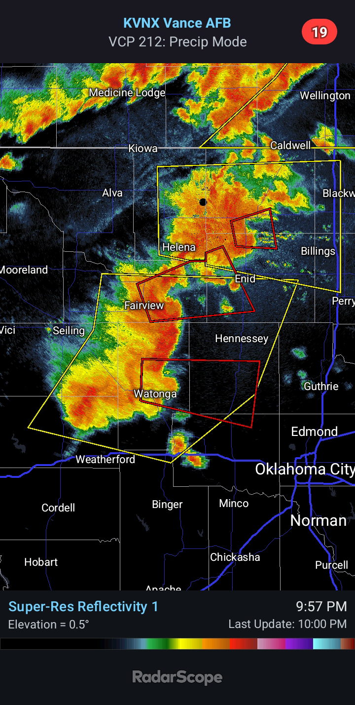
10:00 PM CDT | June 17, 2025 - Multiple Tornado Warnings and Severe Thunderstorm Warnings are ongoing right now. 7:55 PM CDT | June 17, 2025 -   Going forecast looks good this evening. Primary area for Severe Weather over the next couple of hours will be in far Northern Oklahoma, where I have outlined in Red. This is where the greatest risk for Tornadoes will reside in the near term. There is a secondary area that will see an increased risk for Severe Weather, which I have highlighted in Yellow. This area of convection will impact areas along/N of I-40 to the west of Oklahoma City over the next 2-3 hours. This activity will track into the region which was pulsed by various radar sites multiple times earlier today.  Damaging Winds of 60-80 mph will be possible, as well as Large Hail and perhaps even a Tornado or two. 4:10 PM CDT | June 17, 2025 - A TORNADO WATCH is in effect until 10:00 PM for much of Northern/Western Oklahoma. Primary hazards will ...