Posts

Severe Weather LIVE BLOG - Monday, May 19, 2025

Image
12:30 PM CDT -  A TORNADO WATCH is in effect until 7:00 PM for Central and Eastern Oklahoma. There are several supercells ongoing ahead of the dryline. The most intense cell appears to be headed toward Shawnee, and it is exhibiting some rotation on radar. Additional storms will fire along the dryline between 2:00 and 4:00 PM. This boundary will likely reach El Reno by 5:00 PM. Strong Tornadoes are a possibility, in addition to Very Large Hail and Damaging Winds.

Severe Weather LIVE BLOG - Sunday, May 18, 2025

Image
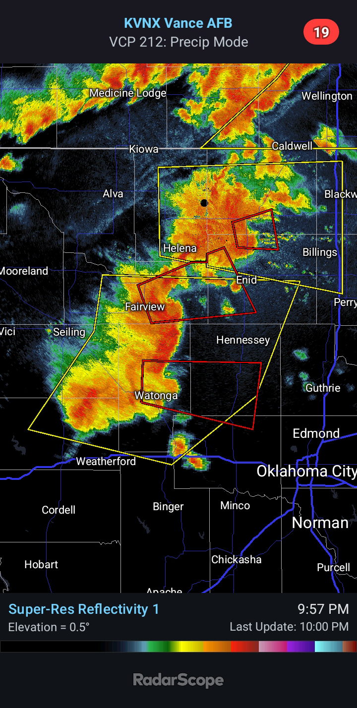
11:50 PM CDT -  Today's Severe Weather event across Oklahoma did not unfold as expected. While it is never good that a forecast busts, it is a positive that this one did. At least a couple Tornadoes did touch down with a cell in Northwest Oklahoma, which originally formed in the Texas Panhandle. Interestingly enough, not a single weather model had forecast ANYTHING to develop in the Texas Panhandle. More on this shortly... Otherwise, the state was largely quiet compared to areas north and south. Multiple Supercells impacted Kansas and Texas. A multi-vortex Tornado was observed to the west of Fort Worth early this evening. In regards to the models, the reason none had any development in the Texas Panhandle is because none had the dryline positioned that far west this afternoon. They all mixed it too far eastward. A few of the hi-res models this evening did not analyze the dew points correctly, and thus, their output is skewed too far to the east. This is an important trend to realiz...

Severe Weather LIVE BLOG - May 17, 2025

3:25 PM CDT -  A TORNADO WATCH is in effect until 10:00 PM for much of Western/Central Oklahoma. 11:30 AM CDT - The SPC is slowly trending in the direction of what I discussed last night. This is referring to the more focused severe potential for parts of Northwest/Central Oklahoma this evening. You can read last night's blog post for more info. The Storm Prediction Center increased Tornado probabilities to 5% for this region moments ago. You can see what the latest HRRR model shows by 9:00 pm this evening. The hi-res Canadian and European models have been advertising similar solutions as well. I still see Strong Tornado potential.